

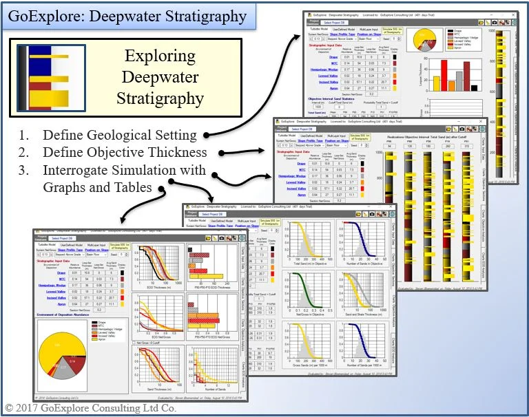
Deepwater Stratigraphy
This tool can be used to create simulated Stratigraphic Sections of deepwater objectives.
It is based on the deepwater research published by Prather et al 2016. ( Sediment partitioning, continental slopes and base-of-slope systems)
The tool creates 500 km of Stochastic Stratigraphy, which then can be analyzed for sand content characteristics. For this simulation the following data is needed:
System Net/Gross
Deepwater Profile Type
Deepwater Position on Slope
User Interface
The User Interface of the Application consists of two parts, 1) the Application and 2) a Database to store Evaluations.
User Interface: GoExplore Deepwater Stratigraphy